
One of the biggest costs to an organisation is asset and facilities management. An organisation can reduce their overall business cost through an efficient and effective location based asset management solution. Location is critical to asset management processes and it’s important to understand where real property, such as offices, warehouses, vehicles, pipelines, computers and desks are located.
Replacing assets too early results in unnecessary expenditure; replacing assets too late can result in downtime, productivity decline, additional costs and, more importantly, unhappy stakeholders. Knowing when your assets need replacing is advantageous in effectively planning where your people resources need to be assigned.
Using geographic information system (GIS) software to do this allows organisations to streamline their asset management operations and make more informed business decisions.
By bringing together X-Info Maps and Maintenance Connection you can integrate management of your assets and facilities with the most popular GIS systems.

Reduce your costs
By automating the asset and facilities management process, you can increase efficiencies, and minimise downtime resulting in cost reduction.

Process integration
The power of integrating GIS functionality within Maintenance Connection creates efficiencies in business processes and improves communication.

Centralise your information
Access the right information, for the right asset, at the right time. X-Info Maps + Maintenance Connection have the tools to allow you to manage physical assets, and simultaneously share the same data with other users.

Increase efficiency and flexibility
The flexibility of X-Info Maps + Maintenance Connection allows you to take total control of your physical assets regardless of location, providing you with efficient response tools in meeting business challenges.

Reporting and customised views
Reporting within X-Info Maps + Maintenance Connection allows you to move from a reactive to a predictive asset management strategy. Providing users with quick and easy access to customised views of asset data is seamless.
X-Info Maps + Maintenance Connection Advantage
X-Info Maps + Maintenance Connection provides you with the capability to visualise and analyse information that cannot be achieved using traditional reporting, through the integration of asset management and GIS systems.
The seamless two way integration of X-Info Maps + Maintenance Connection and your GIS data allows you to:
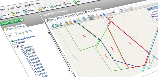
Embed GIS functionality in Maintenance Connection
Visualise assets stored in Maintenance Connection spatially, through embedded GIS functionality. The dynamic linking with X-Info Maps provides the tools to see and understand the physical relationship between assets; spot trends and patterns relating to work management and assist in the prediction of future events.
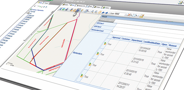
Locate assets and workorders
Viewing asset and workorders in proximity and context of each other and other spatial features improves work planning and analysis while eliminating the need for data duplication.
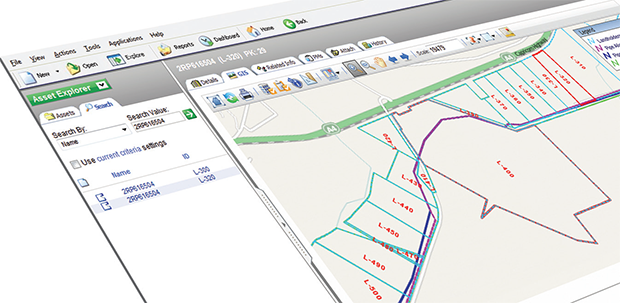
Search assets and facilities
Efficiently locate and display your assets, facilities and workorders on a map through simple address based searching.
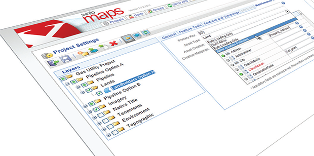
Create assets in Maintenance Connection from your GIS data
Create new assets stored in your GIS data directly into Maintenance Connection, allowing your asset information to be current and consistent. Assets can be created simply and seamlessly, either as a bulk upload or individually as required.
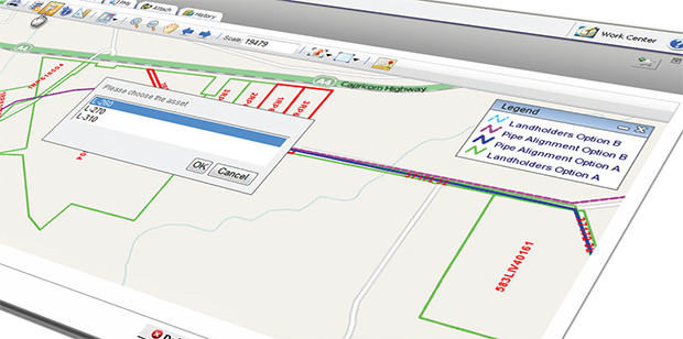
Create and manage workorders spatially
Manage your workorders by locating, querying and creating workorders for an asset within the GIS interface. X-Info Maps + Maintenance Connection allows users to view and access workorders for any asset.
Key applications
- Facilities management
- Property management
- Asset management
Current sectors
- Airports / Aviation
- Education
- Energy Delivery / Power Generation
- Facilities
- Healthcare / Pharmaceuticals
- Local Government / Utilities
- Manufacturing
- Warehouse / Distribution Centres


